LOW LEVEL, LIGHTS OUT MILITARY HELICOPTER TRAINING
Central and southwest texas
Effective. Continuous with NOTAM
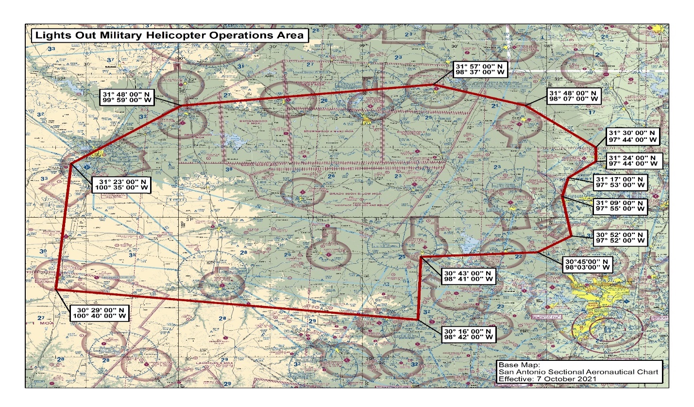
The U.S. Army/National Guard conduct "lights out" tactical helicopter training. These operations are conducted day and night. The night operations are conducted without the use of exterior aircraft lights from the surface up to 500 FT AGL, outside four (4) nautical miles from and public-use airport, and with the boundaries depicted below.
Low Level, Lights out Military Helicopter Training Area
Boundaries. Beginning at lat. 31°24'00" N., long. 097°44'00" W. / North Fort Hood;
to lat. 31°30'00" N., long. 097°44'00" W.; to lat. 31°48'00" N., long. 098°07'00" W.;
to lat. 31°57'00" N., long. 098°37'00" W.; to lat. 31°48'00" N., long. 099°59'00" W.;
to lat. 31°23'00" N., long. 100°35'00" W.; to lat. 30°29'00" N., long. 100°40'00" W.;
to lat. 30°16'00" N., long. 098°42'00" W.; to lat. 30°43'00" N., long. 098°41'00" W.;
to lat. 30°45'00" N., long. 098°03'00" W.; to lat. 30°52'00" N., long. 097°52'00" W.;
to lat. 31°09'00" N., long. 097°55'00" W.; to lat. 31°17'00" N., long. 097°53'00" W.;
to point of origin.
Altitudes. Surface to 500ft AGL.
Times of use. Activated by NOTAM at least 72 hours prior to scheduled exercise.
Controlling agency. N/A (class G airspace).
Using agency. US Army, Fort Hood, TX.
[POC: nathan.shelly@faa.gov], Published Nov. 2021 – 31 March 2023]


