ENR 1.6: ATS Surveillance Services and Procedures
1. General
1.1 The FAA maintains a Keyhole Markup Language (KML) file with information on estimated ATS surveillance coverage on the following website: https://www.faa.gov/air_traffic/technology/equipadsb.
1.2 The full URL to download the file is located at: https://www.faa.gov/air_traffic/technology/equipadsb/research/airspace#interactiveMap. The file contains selectable data on the Continental United States (CONUS), Alaska, Hawaii, Puerto Rico and Guam.
1.3 Geospatial software (such as Google Earth) can be used to open the KML file and view graphical portrayals of ADS-B rule airspace and estimated ADS-B and secondary surveillance radar (SSR) surveillance coverage at selectable altitudes of 500 feet; 1,500 feet; 3,000feet; 5,000 feet; and 10,000 feet AGL.
1.4 Additionally, for Alaska, selectable altitudes of 20,000 feet and 33,000 feet MSL are available.
2. Secondary Surveillance Radar (SSR)
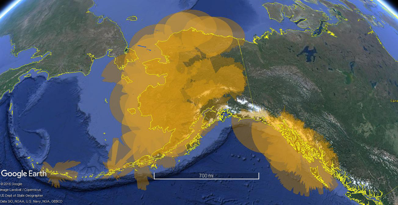
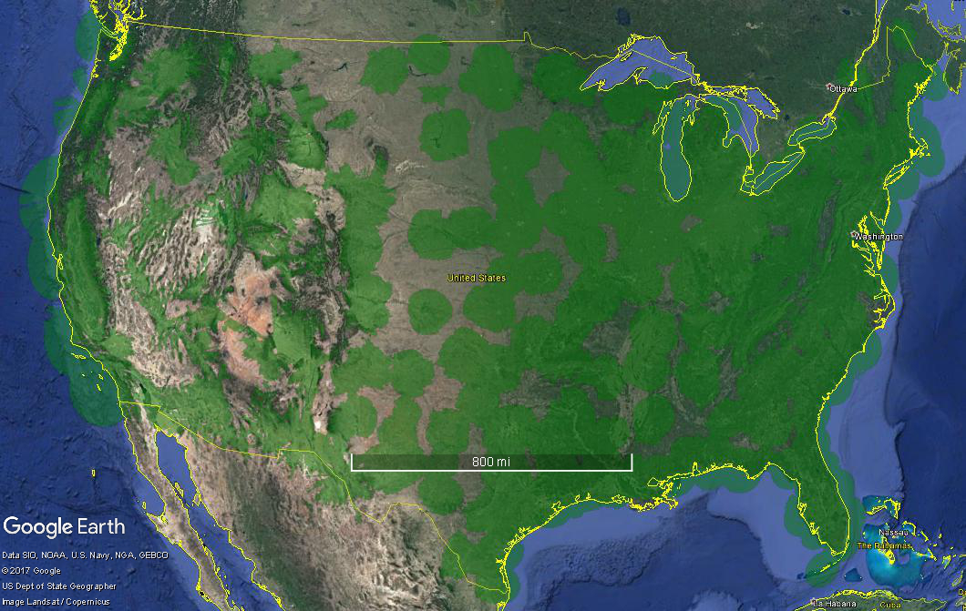
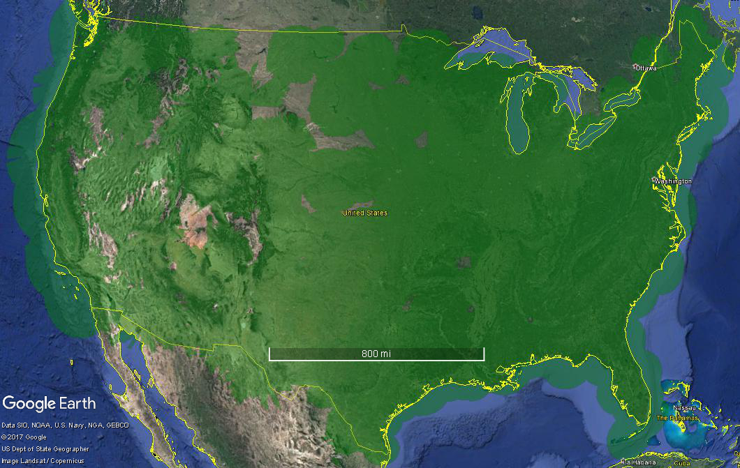
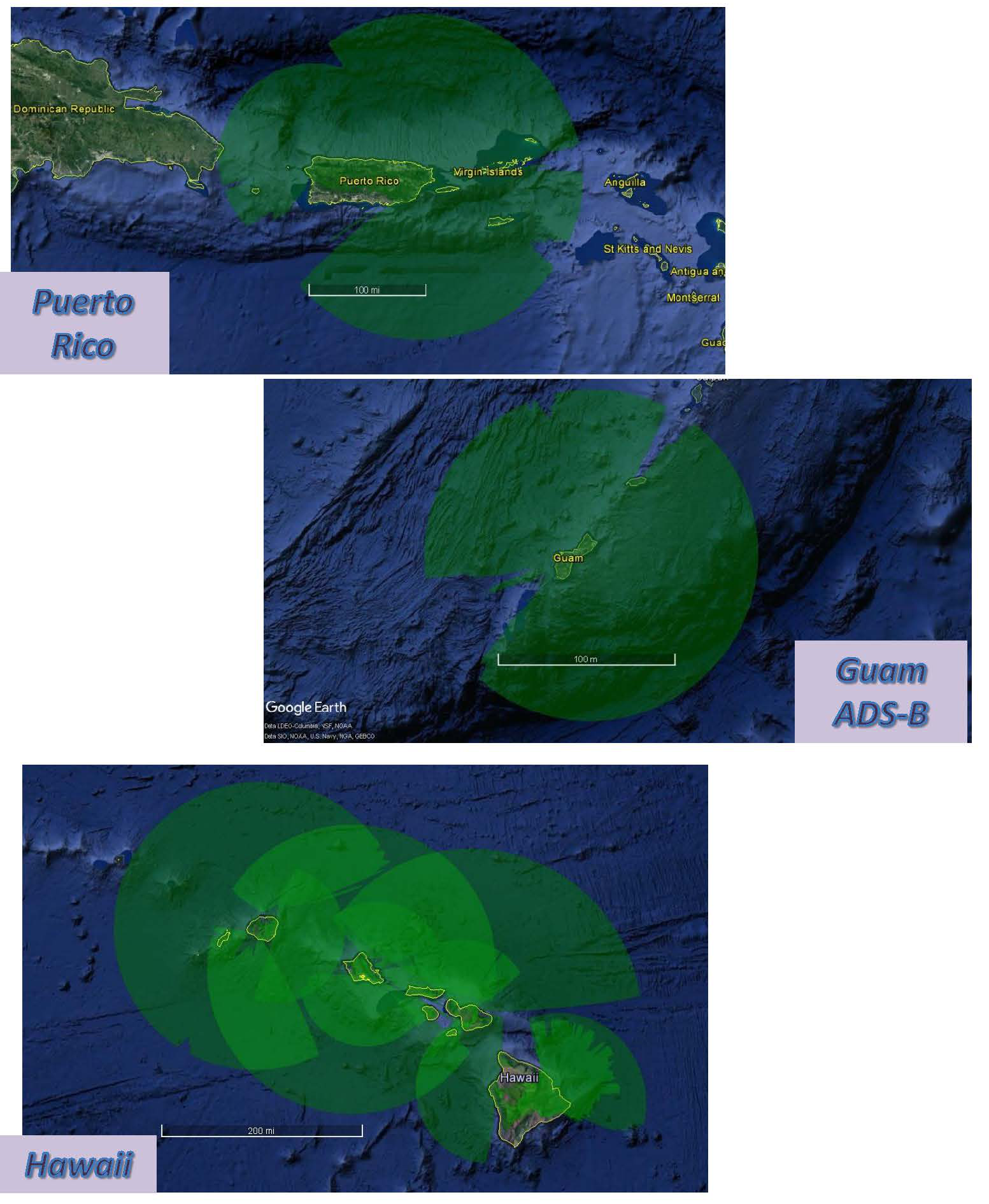
2.1 The following graphics are static portrayals of SSR coverage at various locations and altitudes.
CONUS with SSR Coverage at 1,500' AGL
CONUS with SSR Coverage at 5,000' AGL
Hawaii, Puerto Rico, and Guam with SSR Coverage at 1,500' AGL
Hawaii, Puerto Rico, and Guam with SSR Coverage at 5,000' AGL
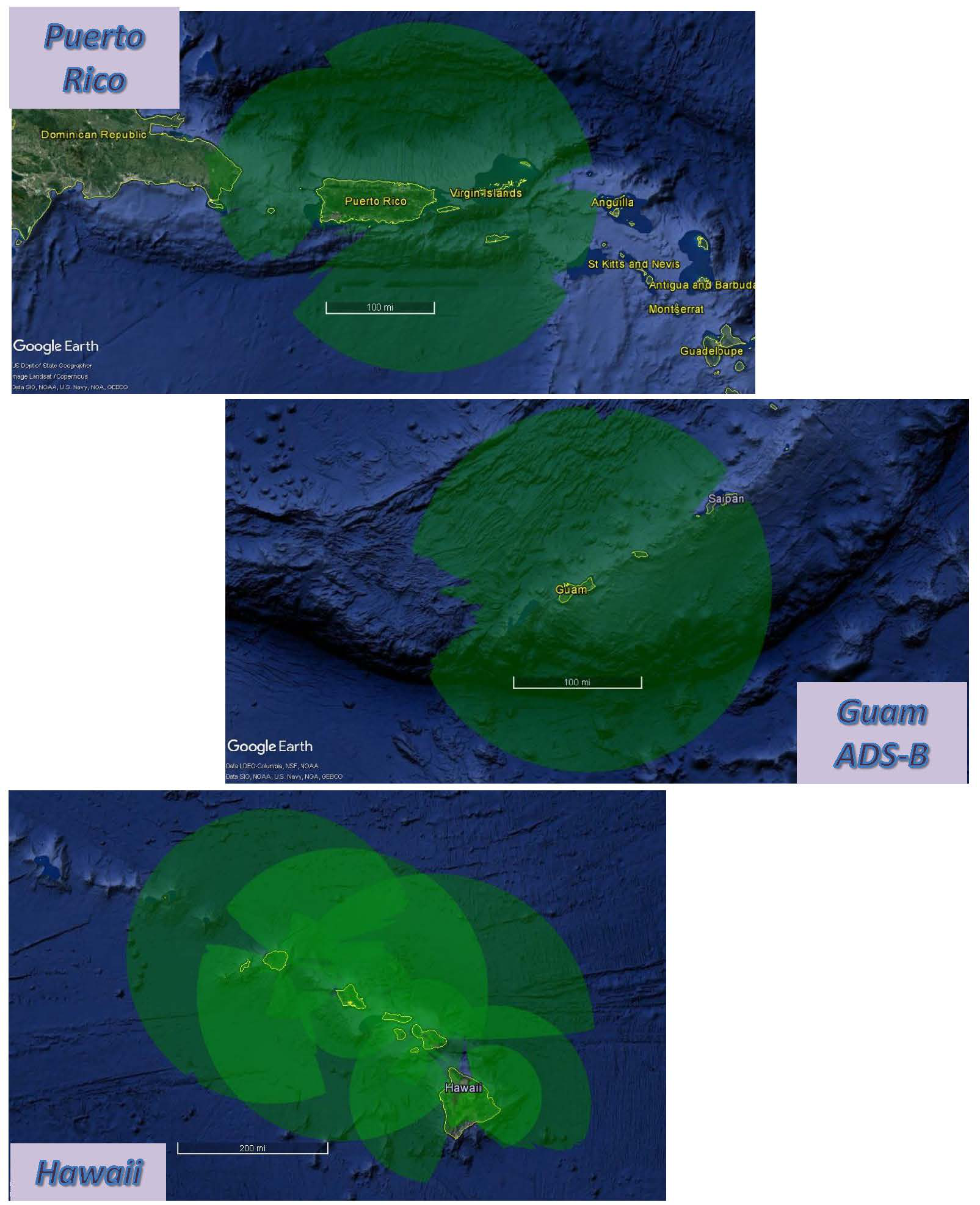
Alaska with SSR Coverage at 1,500' AGL
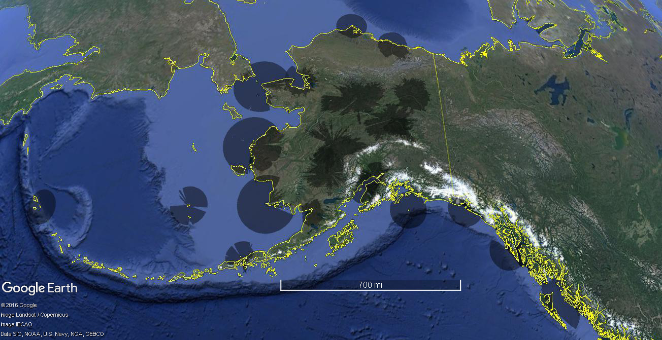
Alaska with SSR Coverage at 5,000' AGL
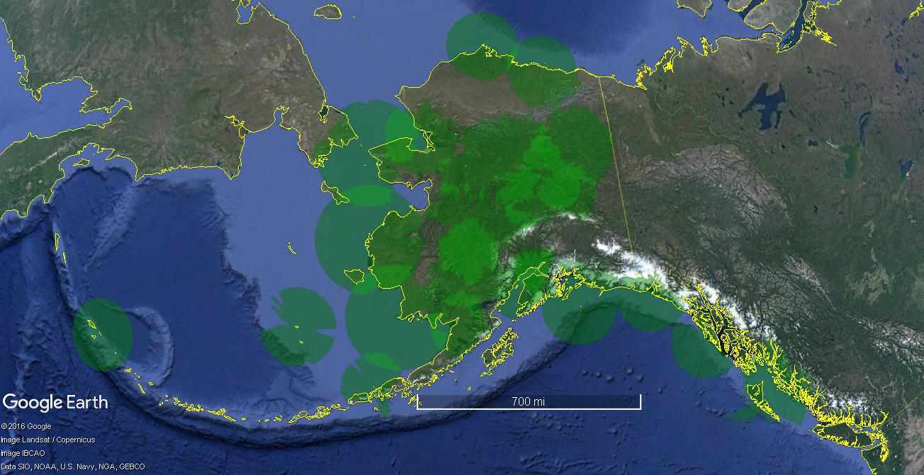
Alaska with SSR Coverage at 20,000' MSL
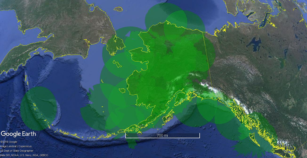
3. Automatic Dependent Surveillance — Broadcast (ADS-B)
3.1 The following graphics are static portrayals of SSR coverage at various locations and altitudes. See ENR 1.6 paragraph 1.1 for details on an interactive version of the portrayals below.
CONUS with ADS-B Coverage at 1,500' AGL
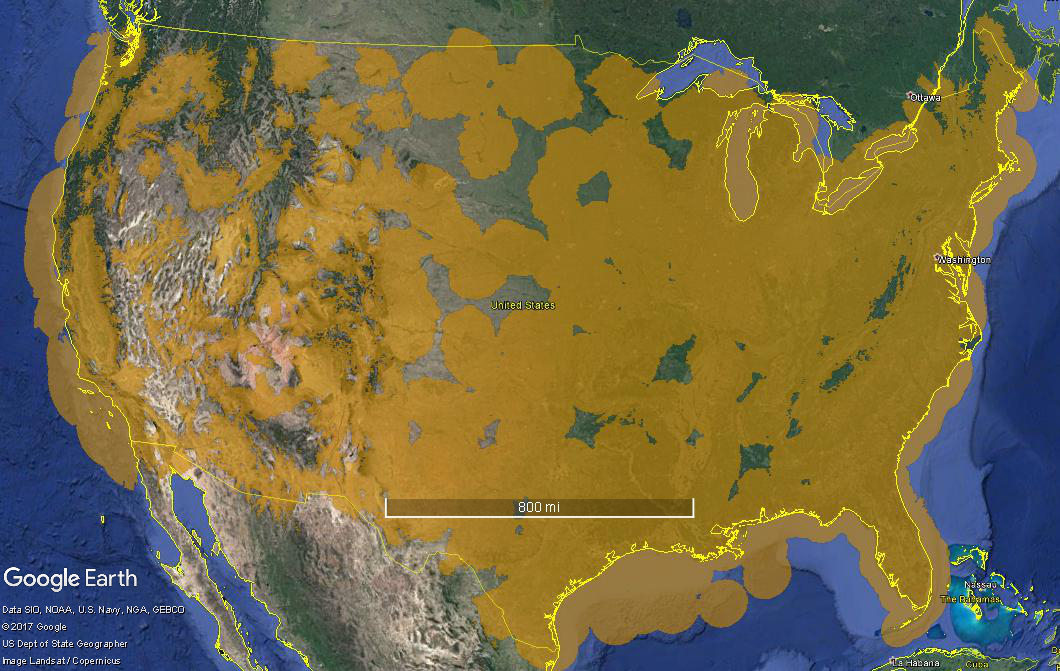
CONUS with ADS-B Coverage at 5,000' AGL
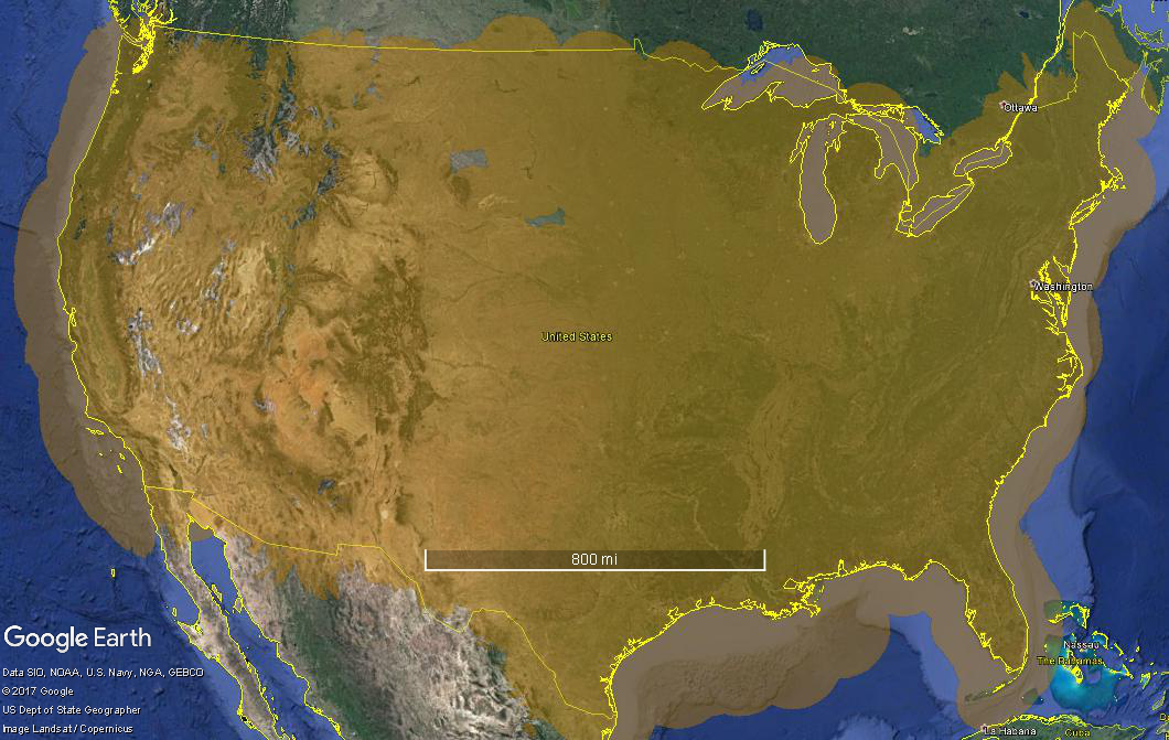
Hawaii, Puerto Rico, and Guam with ADS-B Coverage at 1,500' AGL
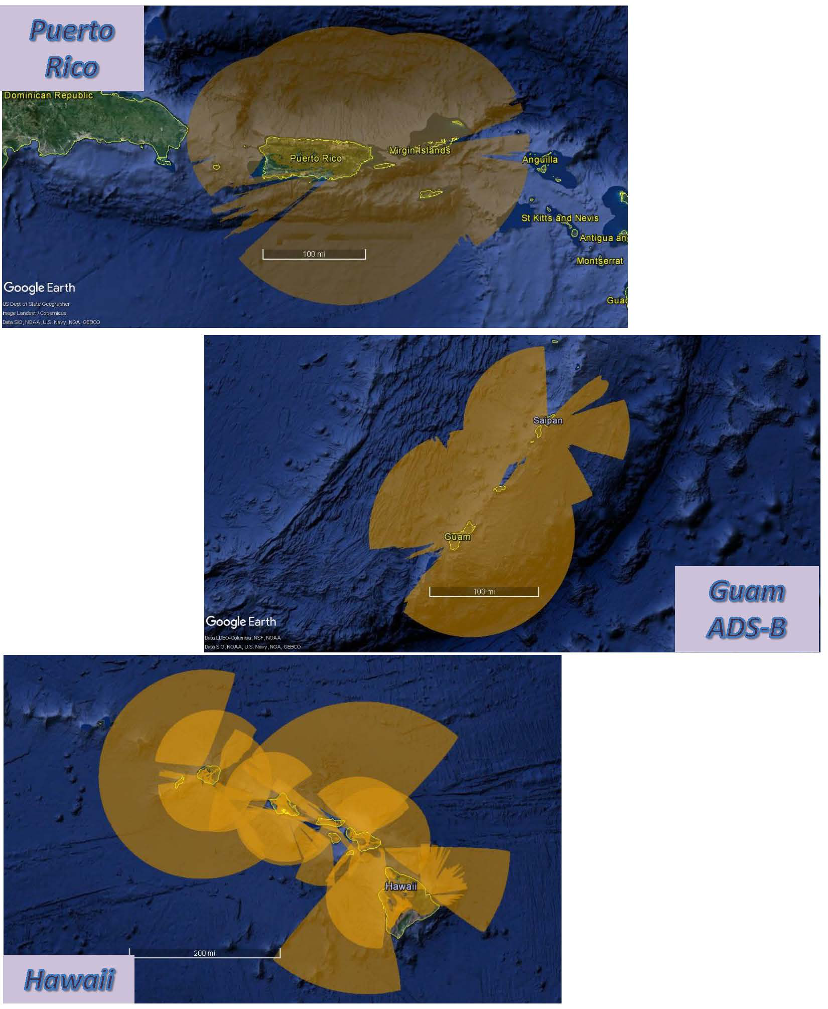
Hawaii, Puerto Rico, and Guam with ADS-B Coverage at 5,000' AGL
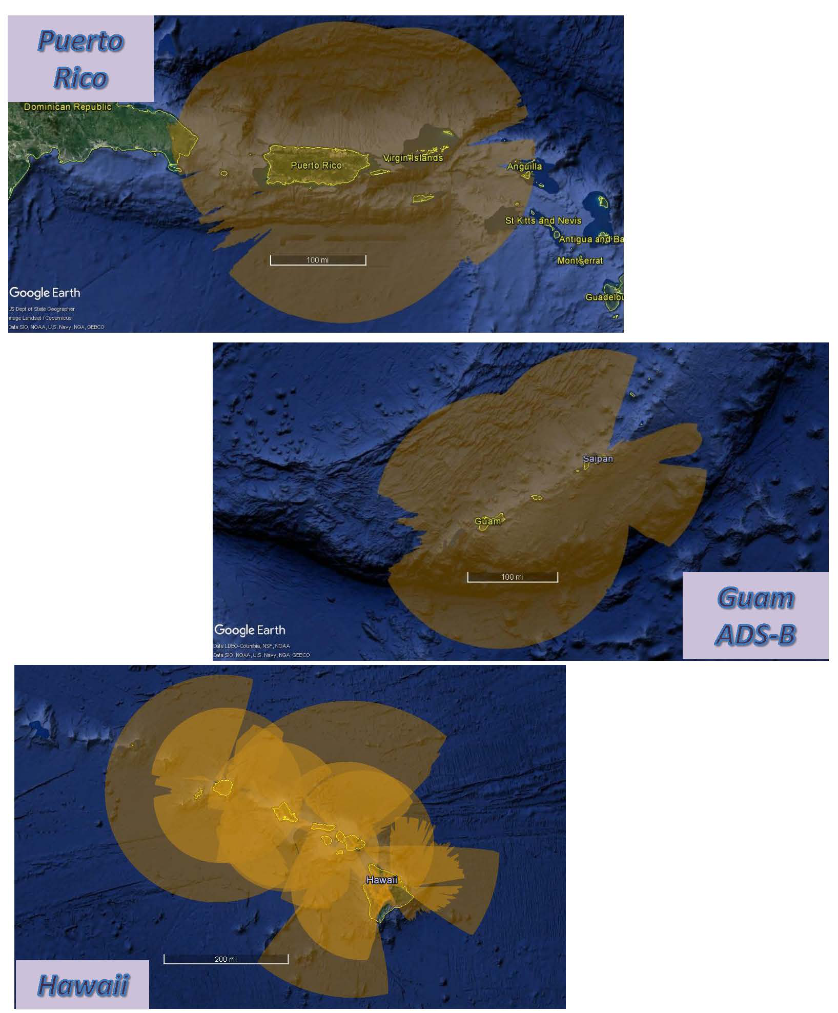
Alaska with ADS-B Coverage at 1,500' AGL
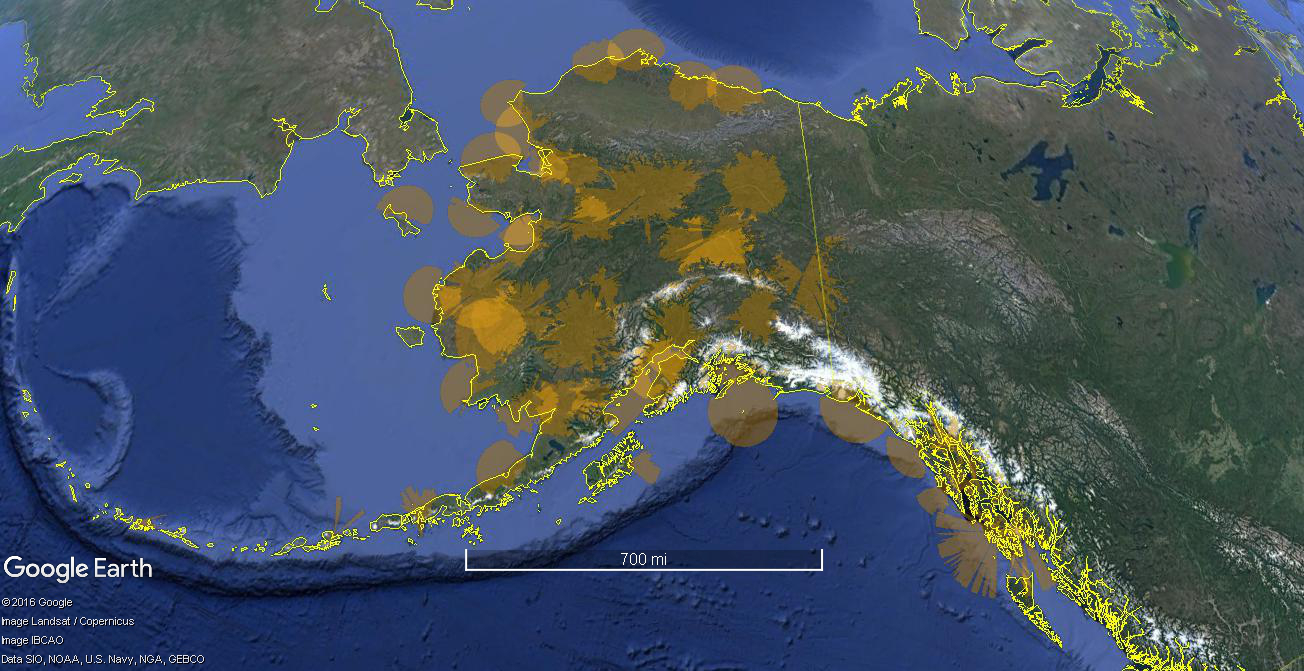
Alaska with ADS-B Coverage at 5,000' AGL
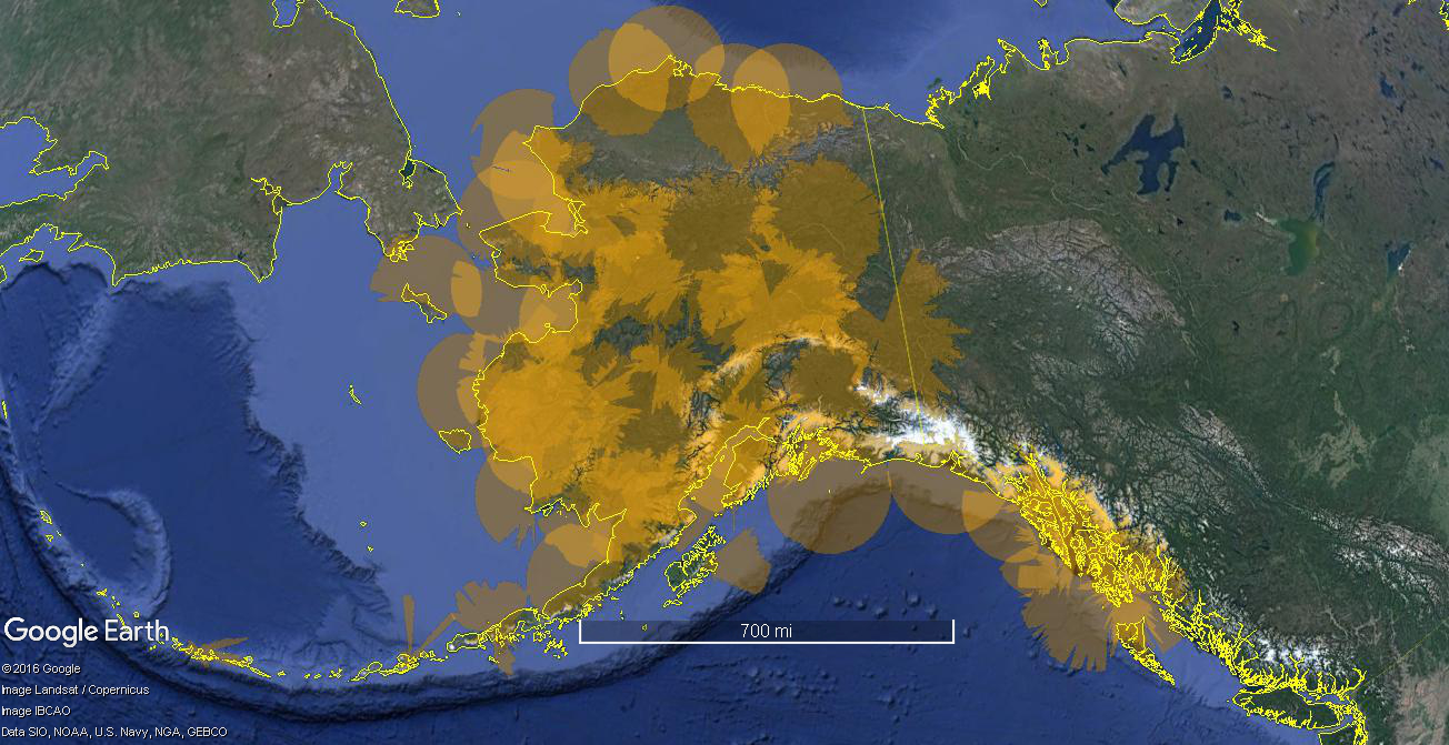
Alaska with ADS-B Coverage at 20,000' MSL
