FAA Weather Cameras: Advancing Safety for 27 Years and Running
For more than a quarter century, pilots have counted on FAA weather cameras to provide clear and timely images of weather conditions to help them safely get to their destinations.
Today, there are 299 FAA camera sites installed at airports, in mountain passes, and on rocky coasts in Alaska and Hawaii, and in 30 of the continental U.S. states. Spurred by the FAA Reauthorization Act of 2024 and the Brand New Air Traffic Control System initiative, the FAA plans to add 64 new weather camera sites at covered airports in the National Airspace System by the end of 2028. This is in addition to the previously planned installation of 160 additional weather camera sites by 2031.
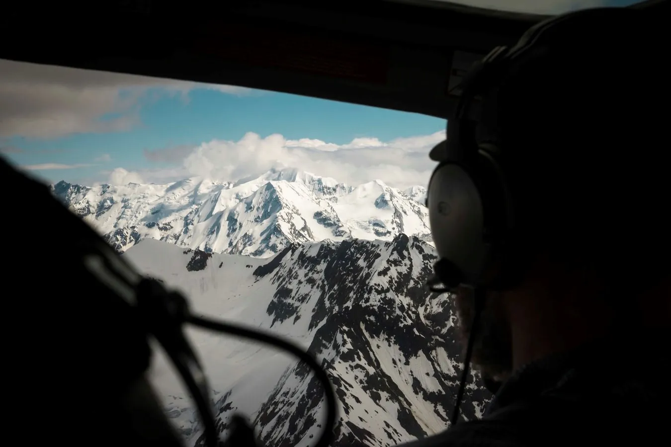
FAA weather cameras, which update every 10 minutes, provide pilots and other aviation stakeholders with near-real-time images of weather conditions at departure, destination, and along flight routes.
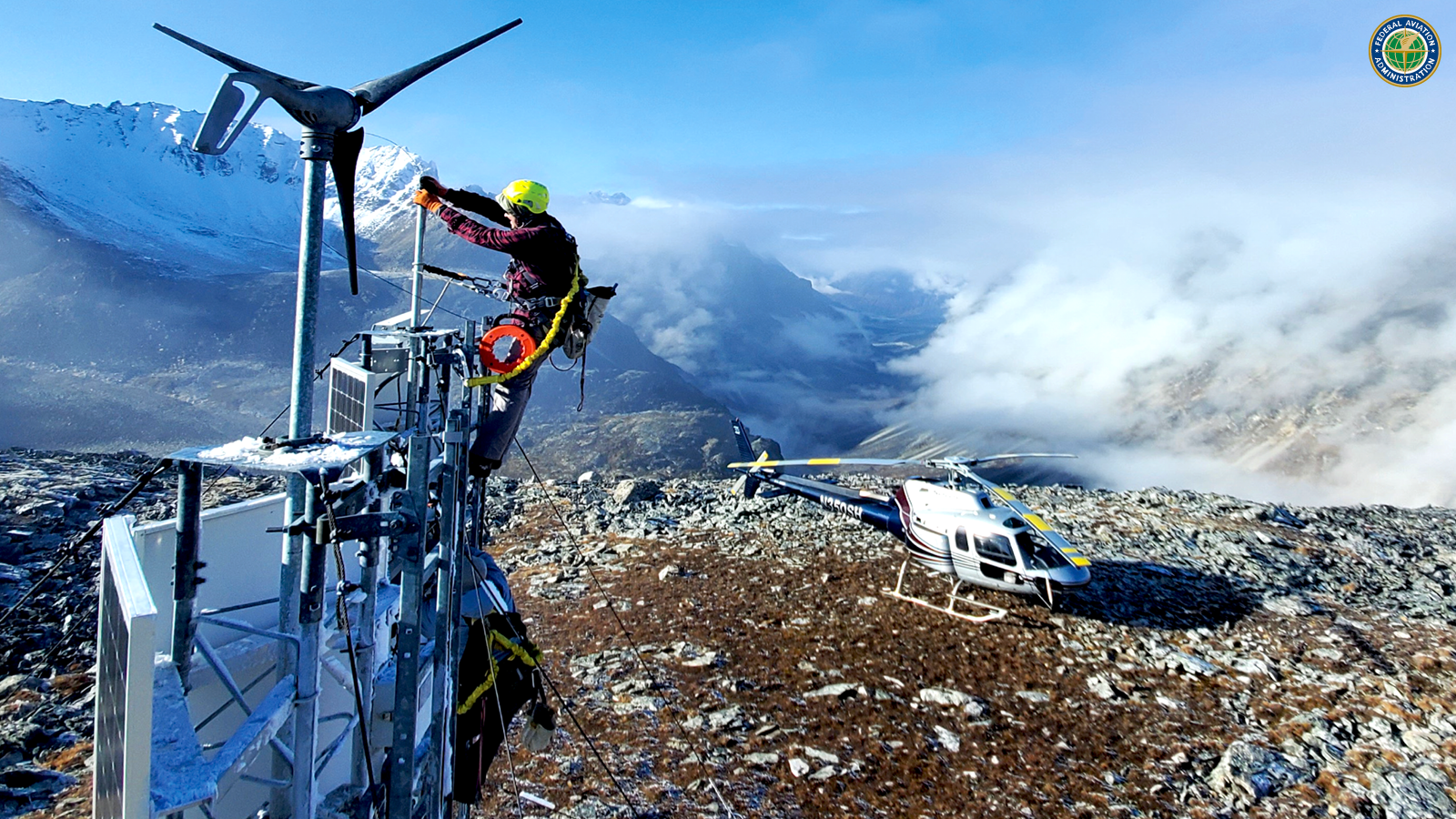
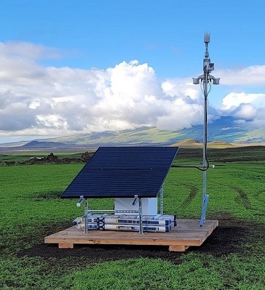
The FAA is also working to improve the weather camera program by implementing a new technology called the Visual Weather Observation System (VWOS). Designed for areas where currently there is no weather reporting system, VWOS will provide aviation stakeholders with both visual and textual information from one platform to aid in flight decision making. VWOS will pair an advanced 360-degree camera system with a full suite of textual weather sensors equal to an AWOS (Automated Weather Observing System) or an ASOS (Automated Surface Observing System) to provide critical weather information pilots need to safely fly into remote airports and landing areas. Sixty new VWOS sites are also planned to be installed by the end of 2028.
There will be improvements in the new systems, says Cohl Pope, the FAA’s Weather Camera Program Manager, including upgrading traditional weather camera sites “from four images in four different directions to a full 360-degree camera that a user can pan, tilt, and zoom to see anything in the area.” The VWOS system will incorporate enhanced 360-degree camera images and also add a full suite of textual weather sensors all on one platform.
Placing FAA weather cameras throughout Alaska has saved a lot of lives, says Adam White, a past president of the Alaska Airmen Association. “The saying a picture is worth a thousand words is definitely true here in Alaska, with the weather camera program,” White said. “Being able to look at that picture, we can make that go/no-go decision before we ever get in the airplane, before we put ourselves in danger.... we love the weather camera program.”
Pope applauds pilots for “taking a look before you fly instead of take off and look” approach. “If you know you’re clear where you’re flying, you definitely have more assurance,” he says.
Weather camera images, paired with textual weather data when available, give pilots a better sense of rapidly changing weather conditions, such as approaching fog banks en-route to and at their intended destination. The images not only increase aviation safety but also reduce operational costs as fewer pilots waste fuel taking off on flights that eventually require weather-related returns.
The cameras have proven their value at airports, dockside to lakes and rivers for float-plane operations, on top of hospital heliports, in mountain passes and near high terrain, and near common flight routes and congested helicopter routes. They are even used for backcountry outdoor recreation in Colorado by skiers and climbers.
You can see weather conditions at sites such as: Clayton Lake, Maine; Dauphin Island, Alabama; Monarch Pass, Colorado; Mojave Air and Spaceport, California; tropically sounding Honolulu, Alaska; or in the real Hawaii at Makaha Ridge.
If you have any thoughts on how to advance aviation safety with weather camera technology or would like to suggest a camera site location, please email 9-AJO-WCAM-ProgramOffice@faa.gov.
You can learn more about how the FAA weather camera program operates by viewing this webinar.