
The Air Up There Podcast
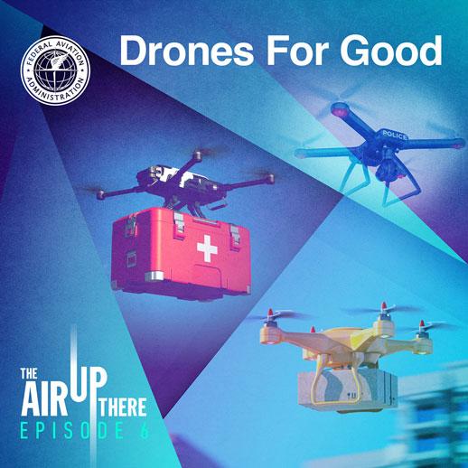
Drones for Good
Season 1,
Episode 6
Published:
Drones are the most rapidly evolving form of aircraft, and while recreational pilots fly them for fun or photography, drones can do a lot more. In this episode, we explore some of the many functional roles that drones play right now — from creating maps in the aftermath of a wildfire and measuring wind speed in the center of a hurricane, to monitoring crops. You'll hear from Commander Tom Madigan of the Alameda County Sheriff's Office, Lieutenant Junior Grade Nicole Chappelle from NOAA's Officer Corps, and James Grimsley, who managed the Choctaw Nation's participation in the FAA's UAS Integration Pilot Program.
- Download (MP3)
Dominique Gebru:
Hey everyone. And welcome to another episode of The Air Up There, a podcast about the wide world of aviation. I'm Dominique Gebru, in for Alison Duquette.
John Croft:
And I'm John Croft. Dominique, imagine for a minute that you didn't work for the FAA and that everything you knew about drones was what you heard in the news. What would you think about them?
Dominique Gebru:
Honestly, John, I feel like I would think of them as a nuisance. We hear a lot of reports of drones flying where they shouldn't be, those backyard pilots who maybe don't understand all the rules. And that can get really dangerous.
John Croft:
Yeah. I'm with you. Well, in today's episode, we're going to talk to three experts who will paint a dramatically different picture of drones. Which as you know, are officially known as UAS or Unmanned Aircraft Systems, or in some cases UAVs, Unmanned Aerial Vehicles.
Dominique Gebru:
Actually, our guests are really doing some very cool stuff with drones. Things like monitoring weather, plunging into active hurricanes as they near landfall, capturing the after effects of forest fires and tornadoes, and helping law enforcement. I can't wait to hear those stories.
John Croft:
Yeah, let's jump in. First up our reporter Kristen Alsop interviews Tom Madigan, commander at the Alameda County Sheriff's office in California, who will tell us about how drones are making public and first responders safer
Kristen Alsop:
Tom Madigan and the Alameda County Sheriff's office have been using drones for nearly five years to assist with their public safety operations.
Tom Madigan:
We feel that the use of a small UAV as close air support, it's really a cost effective means of enhancing public safety. And we view it as a public safety tool. It's not just a police tool. It's not just a law enforcement tool. It's a public safety tool. We'll use drones in a variety of different situations.
Kristen Alsop:
In Alameda County and other parts of the country, drones are used in search and rescue missions, damage assessment like after a fire, and in disaster response.
Tom Madigan:
We'll do mapping and create models of different areas. We'll do panorama 360s, in fact, we did about 500 of them in Santa Cruz a few weeks ago, and they're stitched together on a map. So, residents can go online to the county's website and see, a lot of times, the damage to their properties without having to go back into the dangerous areas. We've also used drones to help the firefighters in disaster response to look for missing persons. Unfortunately many who perished sadly and tragically in the fires. But it's a unique tool to give a bird's eye view, an advantage that our people on the ground don't necessarily always have access to.
Kristen Alsop:
The Alameda County Sheriff Department has been using drones for five years. We asked Commander Madigan what top benefits they've seen so far.
Tom Madigan:
There's a lot of benefits, but I would say the overwhelming, the highest benefit we've seen is overall increase in situational awareness to dangerous situations.
Kristen Alsop:
Many thanks to Commander Madigan and the Alameda County Sheriff's office for sharing that perspective with us. If you're a public safety official interested in starting or expanding your drone operations, the FAA has resources that can help. Visit faa.gov/uas for more information.
John Croft:
That was really cool, Dominique. I particularly liked the part about using drones to generate what they called Panorama 360s so the citizens can get a look at their properties from afar before trying to go there in person and maybe getting hurt.
Dominique Gebru:
Yeah, absolutely. I'm from California originally. Hearing the way that Tom and his team are using drones to monitor wildfires and the aftermath, that stuff really means a lot. Those drones could mean people getting their insurance money faster or finding a lost loved one.
John Croft:
Yeah. And as we'll hear in the next couple segments, that's just scratching the surface for what drones are doing.
Dominique Gebru:
Yeah, John. And next we're going to hear from Nikki Chappelle, she's going to take us on a deep dive into the world of drones as they're used by the National Oceanic and Atmospheric Administration, or NOAA. Nikki's actually an officer with NOAA's officer corps. I didn't really know that that program existed until we talked with her for this episode. Our reporter Jasmine Jackson caught up with Nikki via Zoom. Let's hear this interview.
Jasmine Jackson:
NOAA uses drones to monitor tornadoes and hurricanes. They've been experimenting with models that can actually travel inside of a storm system and collect data.
Nikki Chappelle:
With the manned aircraft, they're flying the P3s into the hurricanes. They also have the G4 that flies above the hurricanes and collects data that way. The actual aircraft that we're developing, a UAS to be used, it'll be launched from a tube on the NOAA P3 into the hurricane. And the idea behind that is that the unmanned system can go into areas of the storm that we wouldn't want to send a manned aircraft into. And the types of data it's going to be collecting could be a relative humidity, pressure, temperature, wind speeds. And all those kinds of data can be fed into models that allow for better predicting of storms.
Jasmine Jackson:
So, when those drones travel into the storm, are they gathering data to provide advanced warning?
Nikki Chappelle:
In the case of the ones that are actually being deployed out of the P3, there was a previous version, The Coyote, that had been deployed into a couple hurricanes. Right now we're developing the new one, the Altius. Working with [inaudible 00:05:56] and that project when it's being launched down, it's while the hurricane is approaching land and they would put that into the storm to collect data and get data before it hits the land. So, it can help with modeling before it hits land.
Jasmine Jackson:
I've heard that drones are also used to map ground scarring, particularly after tornadoes. Can you talk a bit more about what that means and how the data is used?
Nikki Chappelle:
That sort of data is coming post-storm. It's a part of the damage assessment surveys. We have a couple of weather service groups who just started using UAS to go in and look at areas where tornadoes have touched down or where there's been strong wind events, and they actually go fly over those areas and they look at the damage patterns and basically how the trees have fallen and how the storm has affected that area. And from that overarching image, they can see whether or not it was a tornado or just a strong wind event, or exactly what caused that from the damage that they're seeing.
Nikki Chappelle:
Now, the nice thing about UAS is these surveys were traditionally performed on foot, a lot of the surveys they're using the UAS for. By being able to put a UAS up in the air, they're getting to see the area in a lot faster way than they previously would have. And then it also makes certain areas that they wouldn't have been able to access accessible. For example, they recently had one where there was a river that would have been blocking their ability to get to the area. They were able to fly the UAS over the river and view the damage area.
Jasmine Jackson:
How does NOAA work and connect with other entities to share that information?
Nikki Chappelle:
The data that gets collected, all of it is public information. So all that data gets released. It also gets provided to any sorts of councils that are involved in those decision-making processes. And then going beyond that for a lot of our research aspects, we partner with different universities, different companies to develop things to allow us to move forward.
Nikki Chappelle:
We also partner with other agencies to develop new methods of sampling. For example, we're currently working on a high altitude air sampling project, and NASA is partnering with NOAA for that.
Jasmine Jackson:
NOAA is also using drones to monitor marine wildlife. We'll hear more about that in a future episode. Thanks so much to Nikki Chappelle for joining us in this conversation. We hope you learned something new.
John Croft:
That is so cool. Shooting a drone out of a P3 into areas of a hurricane that are too dangerous for even manned aircraft. We see those P3s on the TV, and we know that's about as crazy as it gets. If you can make drones work for us, the people in conditions like that, I can't imagine there's any end to the possibilities for what they can do for society as a whole.
Dominique Gebru:
Absolutely. It seems like the technology is just going to continue to advance. Which is pretty awesome and we get to see that firsthand here at the FAA. John, let's listen to a quick safety tip before our next guest.
Dominique Gebru:
Know and respect the drone laws. Register your drone with the FAA. Drones have become incredibly popular and are a blast to fly. Drone operators are considered pilots. Drones are aircraft and pilots have to follow rules. The U.S. and other countries have drone related laws. And as a drone pilot, it's your responsibility to know and abide by them. It's a big deal. Breaking drone laws could land you a huge fine or liability for causing injury or damage. In some countries, it could even mean jail time. Before you ever fly, be sure to register your drone with the FAA. Find the most up-to-date rules for drone pilots in the U.S. at faa.gov/uas. Happy flying.
Dominique Gebru:
Welcome back. Before we go to our next and final segment, I want to explain some of the terms we're going to hear. Our reporter Laura Brown spoke with James Grimsley, who is the executive director of Advanced Technology Initiatives in the Division of Strategic Development for the Choctaw Nation of Oklahoma. Laura is talking with James because the Choctaw Nation was a lead participant in the FAA's IPP, which stands for Unmanned Aircraft System, or UAS, Integration Pilot Program. The IPP has brought state, local, and tribal governments together with private sector entities like drone operators and manufacturers to test and evaluate the integration of civil and public driven operations into our national airspace system.
Dominique Gebru:
Basically, the drone industry is growing rapidly and through the IPP, the FAA worked with the groups I just mentioned to create a meaningful dialog around drone integration into the airspace. The program came to a close in October of this year, but to continue the work we launched a new program called beyond. James Grimsley led the proposal development and capture for the Choctaw Nation's participation in the IPP. So James really knows his stuff in this interview. James is going to tell us about some of the things that the Choctaw Nation has been using drones for, including monitoring extreme weather and crops. That's such a practical use for drones, John, and I don't think the average person would think that drones could play such a functional role in farming, but it helps them cover a lot of ground really quickly.
John Croft:
Thanks for the background, Dominique. Okay. Let's take a listen to Laura's interview with James.
Laura Brown:
Hi, James. Thanks for being with us today. So, you're in a part of the country that unfortunately has a lot of tornadoes. Can you talk a little bit about the way you've used drones to survey tornado damage and help NOAA?
James Grimsley:
Sure. There's actually two elements going with severe weather in our IPP. Not only the IPP, but other collaborations we have with our academic partners. Severe storm research obviously is a very big deal in Oklahoma. In fact, several of us that are involved in the UAS, our first exposure to UAS was in the late 1980s when we were looking at the potential of unmanned aircraft, obviously we didn't call them unmanned at the time. It was all remotely piloted and operated. But we were looking at those types of technologies to be able to get instrument packages closer to active tornadoes. There's still a lot at that time we didn't understand, and it's still an active area of research. But there's actually two elements of it. First, we must improve our predictive capabilities and our ability to forecast. Right now, the way we forecast storms, we overdo it.
James Grimsley:
We can't always pinpoint where outbreaks are going to be. We look at the likelihood and we have to issue warnings. A lot of times it may be broader than need be. That creates a situation where the public doesn't always necessarily listen. You grow immune if you are constantly hearing warnings and subjected to storm warnings and those storms don't occur. So, we must improve our predictive capability. And we're starting to realize that UAS allow us to get into the active areas of the atmosphere, the lower boundary layer, and in places to do measurements. That data, if we can start to get it in a regular way, can improve our storm models. But also what we've sent on IPP is in addition to supporting that type of research with our academic partners, UAS can be immediately available to do storm assessments and flyovers.
James Grimsley:
And so during our IPP, we've had some tornado outbreaks within our area. We were contacted by the emergency management within the tribe, as well as the other communities. And we were able to very quickly respond and do overflights of some of the paths. The meteorologists and the agencies involved in assessing the severity, assessing what is an F1, F2, whatever, were able to reclassify some of the tornadoes that had occurred because of the footage. Look at the scale of damage, the pattern of damage, and then they were able to reassess and more accurately described that. The communities were very interested and really happy that we did that because they all requested copies of the video and photos. They wanted this for insurance claims and to help them with the the post-storm recovery efforts. So, it was something that was very positively viewed. It had multiple benefits, not only for landowners and homeowners and property owners, but it also had that benefit to the scientific community and that we can more accurately assess of the intensity of the storms.
Laura Brown:
I know that you found a lot of agricultural applications for drones. Can you talk about a few of those?
James Grimsley:
We ensured that when we started our IPP and were putting our team together, that we wanted realism and we made a commitment to ourselves and others that we would always start with missions that were real. We would always start with a problem. This is a problem in agriculture. This is a problem in public safety. And so we brought aboard, as one of our core team members, the Nobel Research Institute, which is, my understanding. I think it's the largest nonprofit agricultural research organization in the United States. Incredible body of expertise, domain expertise there. And so we actually started with them to assess what are the problems that are out there that maybe we could solve using UAS. So, we started with a problem, and then we started with the ones that we could actually do economic analysis on. What's the viability, what's the current cost of doing it with current techniques versus what are the benefits we would get with UAS?
James Grimsley:
Because we wanted to be able to track and trace that. Unfortunately, what happened … I've been in the UAS virtually my entire career in some form or fashion. But in the early days, when we started looking at commercial opportunities, seven or eight years ago, everyone tended to focus on crops, where we overflew crops. And when people thought of agriculture, they thought of crop based agriculture. Really agriculture is far broader and more diverse than that. We have a lot of herds and grazing animals that are involved in agriculture. And then we just have agricultural operations. So, we wanted to look at some of these unique ones that were somewhat overlooked early on that may have more immediate opportunity. So, some of the things we looked at, a lot of places in Southeast Oklahoma, pecan groves, pecans are actually a very profitable crop in terms of how much you can do per acre once you are able to establish a mature pecan grove.
James Grimsley:
We started looking at these applications that do not justify things like manned helicopters. The cost of a manned helicopter, just the operation, all of these things like that. We looked at these things where there seems to be missing of solutions. And so, one of the issues with pecan trees, it's difficult to assess yield and it's also difficult to assess crop health. A lot of times you need to look at it from above and get up above these pecans as they're maturing and growing and the trees to seed them. And it's almost impossible to do from the ground level. You can have severe problems and not see it from ground level. It's difficult to get into these trees. It's not safe climbing up in ladders and climbing through the branches.
James Grimsley:
We found that it's very efficient, that we can very quickly fly a small UAS, very cheaply fly a small UAS and assess, do we need to spray these trees? Do we need to take some measures to help prevent damage or prevent some sort of either rot or disease? And so we've seen significant interest and we keep getting repeat invitations to come back and fly again, because some of these people that are managing and owning these pecan groves are finding it very, very useful.
Laura Brown:
So it sounds like you have a variety of different missions and you might need different types of drones for that. How many drones do you actually have?
James Grimsley:
I've actually lost count. The latest that we acquired is a bigger system that can carry about 50 pounds. Most of our stuff is multi rotors. We do have some fixed wing and we see these interesting systems and we're working with partners that have those. We also acquire them, we have [inaudible 00:17:16] type that can transition to horizontal flight. We have quite a few. We did work with the Volpe Center because we had enough diversity. We had two things going for us, a diversity of vehicle types, but we also had location to fly where we had a very low noise floor, no anthropomorphic noise. So, the IPP, all of the acoustic testing for the IPP was actually done with the Choctaw Nation on our 44,000 acre site. It actually turned out very, very well with the Volpe Center. We have quite a few, but we look at this as we want to do our part to help stimulate the economic opportunities.
James Grimsley:
And so we're constantly looking for people that are developing things that may be useful. We want to continue to enter into those partnerships. And we want to also facilitate operators. There's certain things we may do as a tribal government. We are the first public aircraft operator that's a tribe. We were the first tribal government recognized as such. And we're very grateful about that, but we also want to see industry emerge. We want to see companies that are doing delivery. We will all benefit when that happens in our area. We will continue to acquire some. We have quite a few, we will continue to do so. But we also will encourage our industry partners to do that and to step up and hopefully start to reap some of the benefits of the economic opportunities.
Laura Brown:
Thank you for joining us today, James. That was really interesting. I appreciate your explaining all of this to our listeners.
James Grimsley:
Well, thank you for having us and also thank you for recognizing the work of the Choctaw Nation. We're very excited about the future and where this technology may help lead us.
Dominique Gebru:
All right, John, let's get to one of my favorite parts of our episode. Let's hear some trivia.
Speaker 9:
What cost-saving measure did American Airlines institute in 1987 that saved the company $40,000 in one year?
Speaker 9:
American airlines save $40,000 in 1987 by removing just a single olive from every salad served in first class.
John Croft:
Well, that's a wrap for today, Dominique. I don't know about you, but I've got a much better feel now for the kinds of real work that drones are involved with. They aren't just taking the place of people, doing the same jobs as people. You're creating entirely new ways to solve practical problems that might otherwise be insolvable or dangerous for people.
Dominique Gebru:
I agree, John. And honestly we barely scratched the surface of some of the coolest stuff that people are using drones for. Listeners out there, if there's something you'd like to hear more about on a future episode, please let us know. You can send us a message on social media and you might hear your idea in an episode soon.
Dominique Gebru:
And that's a wrap for this week. The Air Up There is a podcast produced by the Federal Aviation Administration. If you liked this episode, please subscribe, rate, and review us on Apple Podcasts. For more information about a lot of the innovative work that the FAA is doing with drones and other areas in aviation, you can follow us on social media. We're @FAA on Facebook, Instagram, and LinkedIn, and @FAAnews on Twitter and YouTube. Thanks for listening.