


Too Much Weather: How to Choose Which Resource to Use and When
By William E. Dubois, Contributing Writer
The early airmail pilots called farmers down range — on their party phone lines — to ask about the weather along the route. Naturally, a farmer’s view of weather and a pilot’s view of the weather aren’t the same, so there was inevitable trouble. But it was the best information at the time.
Fast-forward a hundred years to the Golden Age of Air Travel, with a wealth of weather products available through government and commercial websites, feeds, and apps. The challenge for the modern pilot is knowing what to look at and, perhaps more importantly, when to look at it.
As it turns out, certain types of weather products are best suited to particular windows of time ahead of a flight. Here, just in time for the next “mail run,” is a time-to-flight guide to weather products.
1 Week Before Your Cross-Country Flight
When it comes to long-range weather, the only accurate prediction is that the further out the forecast, the less accurate it is. So, while many weather products offer forecasts out to ten days, or even longer, at this range, the Farmer’s Almanac is likely to be as accurate as a scientific forecast.
That said, there’s one type of weather product that’s helpful when looking at weather very long range, and that’s the Surface Prog (Prognostic) Chart, from the Weather Prediction Center’s website. This chart is also included in many electronic flight bag (EFB) apps. (Note, not all EFBs include the longest-range surface analysis charts). A prog chart is a computer-generated map that displays the anticipated state of the atmosphere at a specific time in the future, whereas an analysis chart shows current conditions.
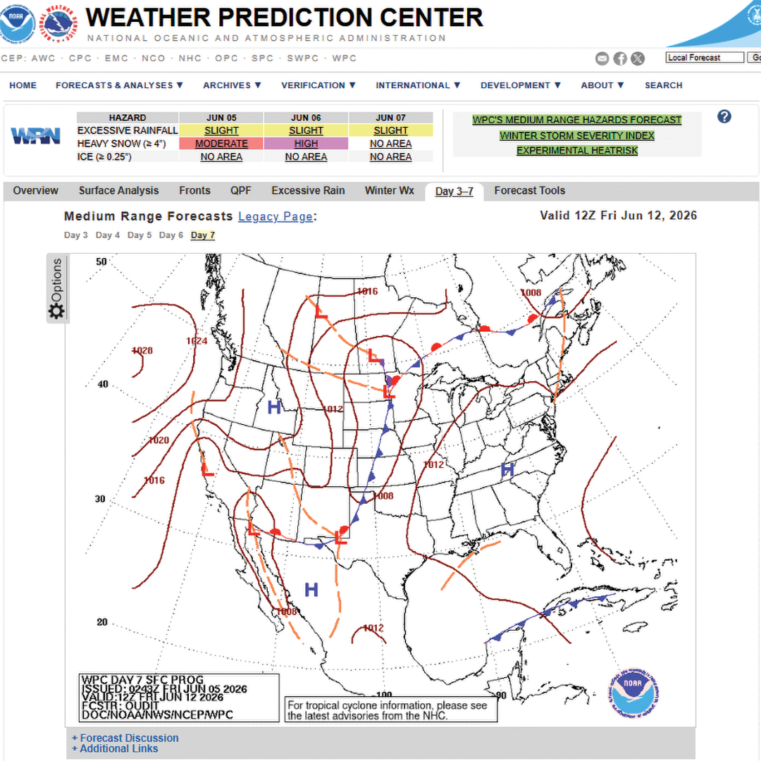
The prog chart offers only the very broad strokes of the predicted weather — basically, pressure systems and fronts. As this is big-picture weather, be sure to look at the big picture itself: use the national chart rather than a regional one and use it to assemble a mental image of not only the weather over your route, but what could be over the horizon as well. This far out, the predicted weather is unlikely to be exactly where it’s forecast, but it’s likely to be somewhere in the vicinity.
The best use of prog charts is to treat them like children’s flip-books. Pilots should look at them several days leading up to their target date. This will give pilots a moving picture of how pressure systems and fronts are projected to travel across the country. The nature of the fronts tells pilots what kinds of clouds, ceilings, and precipitation they might encounter, and the location and number of pressure systems give clues to possible wind speed and direction.
5 Days Before Your Cross-Country Flight
In the five-day window, try using Weather Underground, which, in addition to National Weather Service (NWS) data, leverages crowd-sourced data from tens of thousands of personal weather stations. Weather Underground’s 10-day tab gives a nice graphic display of key weather metrics day-to-day and lets pilots get a sense of how stable, or not, the upcoming weather will be.
Another benefit of Weather Underground is that pilots can get a forecast for even the smallest, most out-of-the-way airport, which is not true of most aviation weather forecasts. It does, however — like most commercial weather products — lack ceiling data.
3 Days Before Your Cross-Country Flight
Once a flight is three days out, check out Air Sports Net’s Aviation Weather Report at usairnet.com. It’s a free website that uses NWS data but displays it in a graphic meteogram-esque dashboard that provides pilots with an effective visual summary of upcoming weather. That said, the site only gives forecasts for a limited number of airports, which must be selected from a drop-down menu by city name. If a pilot’s flight is in a part of the country that’s new to them, they will have to spend some time in Google Maps figuring out which forecast locations are closest to their flight path. But the dashboard does include ceiling data information — both the lowest cloud level and the ceiling base — that’s especially critical for VFR flyers.
Although strictly a text-based product in our graphic era, the Area Forecast Discussion — available either online or via your EFB by tapping almost any airport — is often enlightening and a good choice several days before a flight. The discussions give pilots a regional perspective on the forecasted weather, as well as the relative strengths and weaknesses of the particular forecasts. They are written by NWS forecast staff in the various offices, and while sometimes a bit overly technical, the personality of the individual authors often shines through, giving them a human touch.
2 Days Before Your Cross-Country Flight
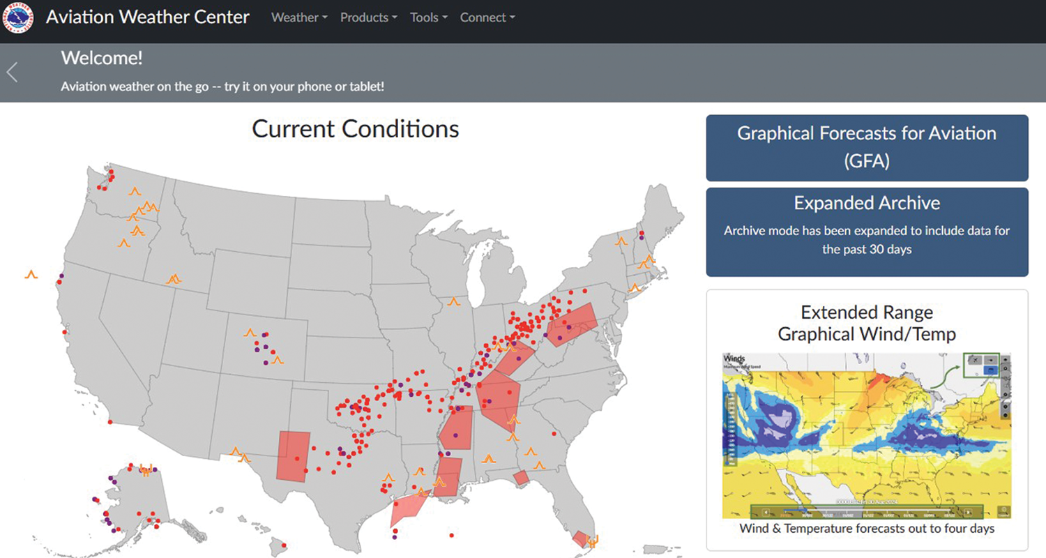
As a pilot’s flight closes in, their new best friend is the GFA, or Graphical Forecast for Aviation, found at the AviationWeather.gov website, a product of NWS’s Aviation Weather Center.
This is an amazing public tool that lets pilots visualize a wide variety of weather, as well as graphical SIGMETS (significant meteorological information) and AIRMETS (airmen's meteorological information), over a zoomable map of the country. But, like the ecosystem of weather products itself, the number of options can present a challenge. If a pilot selects every possible option and layer to display, they will have difficulty being able to interpret anything. But if they limit their viewing options to their specific needs and mission, it’s highly effective.
One standout feature of AviationWeather.gov is a sliding bar at the bottom of many maps that lets a pilot slide back and forth in time to “see” how the weather is forecast to move and change. This is a great tool to help a pilot’s decision-making process when it comes to weather-triggered accelerated or delayed launch times.
Another tool allows pilots to superimpose their route of flight over many of the forecast maps for enhanced situational awareness during weather study.
The Night Before Your Cross-Country Flight
Now it’s TAF time, the terminal aerodrome forecast. TAFs are issued for around 700 airports in the country, so while there might not be forecasts for the airports a pilot is landing at, or their alternates, there will likely be one close by.
Many EFB providers also have their own proprietary plain-English versions of TAFs called an MOS, for model output statistics. Airports with TAFs always have an MOS; these generally extend the forecast to three or more days (the TAF only goes out 24 to 30 hours) and break the forecast into smaller slices of time, which is nice in dynamic weather conditions. MOS forecasts are also often available for airports that don’t issue TAFs.
Wind prediction mobile apps are another popular night-before tool among many pilots and can help visualize wind speed and direction over the route of flight. The Windy app, for example, animates forecast winds with meteor-like moving streaks, color-coded for velocity, and features a time slider for future-casts.
The Morning of a Pilot’s Flight
First, get the standard briefing online at 1800WXBrief.com. If a pilot has any questions or is unsure about the briefing, they shouldn’t hesitate to call Flight Service. The local perspective of the briefers is invaluable, especially if the pilot is flying to an area of the country where they are not intimately familiar with the sky. Often, Flight Service can clue a pilot in to how local geography or other factors can impact the forecast.
In Flight
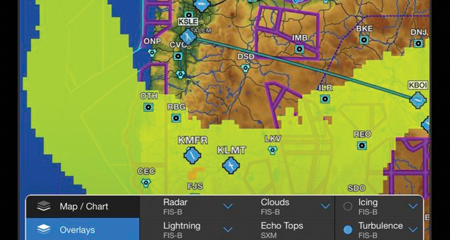
In flight, for strategic planning, Automatic Dependent Surveillance-Broadcast In (ADS-B In) feeds of ground-based weather radar can show a pilot the approximate position of precipitation. At fuel stops, EFBs also do a splendid job of displaying the bands of winds aloft for choosing a groundspeed-friendly altitude, and some of them interface with the growing network of FAA weather cameras that let a pilot “look out the window” at the weather of an airport hundreds of miles away. If a pilot has not seen one of these in action before, each camera shows the current view and displays a clear-day reference image so that the pilot can judge how different, or not, the real-time feed is from what it could be. Real-time data and images are available at more than 900 camera locations across the U.S. and Canada (weathercams.faa.gov).
An EFB is also a handy tool for checking recent METARs (meteorological aerodrome reports) over and around your route to get a sense of ceilings, visibility, and winds. And again, at fuel stops, EFBs offer a quick way to look up the telephone numbers for Automated Weather Observation Systems (AWOS) and Automated Surface Observation Systems (ASOS) stations out of radio range, for real-time weather checks ahead on your route.
Yeah. Basically, a pilot‘s own aviation-savvy (robotic) farmer.
William E. Dubois is a widely-published flight training subject matter expert, and a dual master ground instructor accredited by both MICEP and NAFI. He is an airplane owner, a commercial pilot, and a program manager at Infinity Flight Group’s New Jersey headquarters.