
East Texas Regional Airport (GGG)
East Texas Regional Airport (GGG) is a medium sized, multi-use airport located south of the city of Longview, TX. The traffic mix consists of primary flight training aircraft, air carrier, military, and several flight schools. View a printable Pilot Handbook of the GGG information found on this Web page.
Know Before You Go
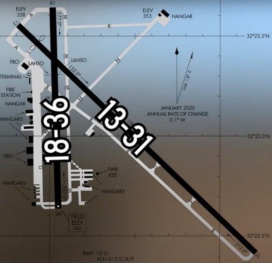
The airport configuration consists of two intersecting RWYs designated RWY 13/31 and RWY 18/36. Parallel TWYs are located alongside both RWYs. Most of the services and facilities are located west of RWY 18/36, however, there area few hangars and a flight school located around the perimeter of the field.
The airspace at GGG is Class D and underlies the Longview Terminal Radar Service Area (TRSA). (Refer to Sectional Chart.)
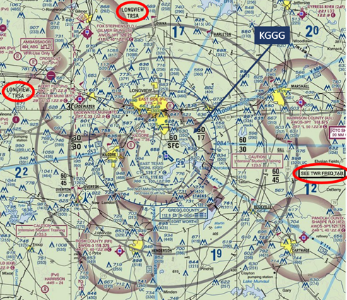
For additional information on TRSAs see AIM 4-1-18.
For information on Longview TRSA Frequency refer to Chart Supplement GGG
GGG TWR Hours of Operation: 0600L-2200L
Administrative Office: Open 0800L to 1600L - M through F
Business Phone: 903-643-4016
Below find various GGG-specific information and things to be aware of, as well as general information to inform your preflight planning. This will be reviewed quarterly and updated as needed. This information is to supplement the From the Flight Deck Videos that are produced by the FAA Runway Safety Group. Here you will also find information provided by the local air traffic controllers at the airport where you intend to fly. The information is subject to change. Not for navigation or legal* pre-flight action. Always refer to official pre-flight materials such as, but not limited to, NOTAMs, airport diagrams, VFR charts and airport construction notices for the latest airport-specific details.
Hot Spots
- There are no Hot Spots at GGG.
Takeoff/Departure
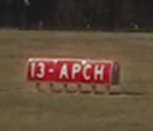
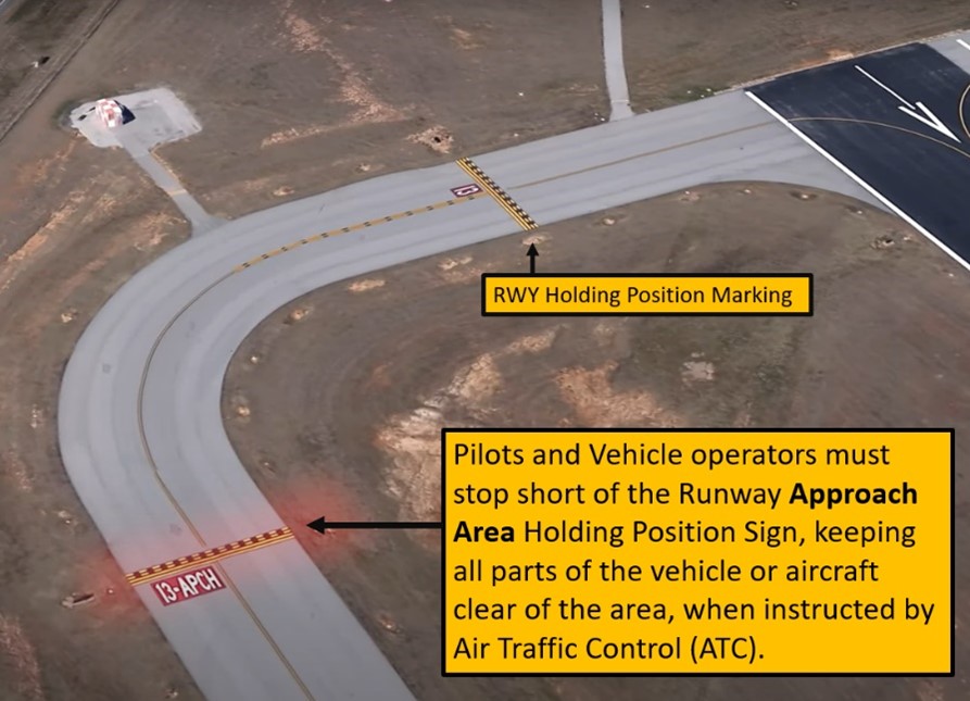
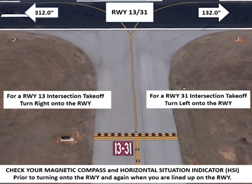
- Note that the RWY Approach Area Holding Position Markings and Signs are located a considerable distance from RWY 13.
Wrong Surface Intersection Takeoff
- Wrong direction intersection departures have occurred primarily on RWY 13/31.
Wrong Surface TWY Departure
- There are full-length parallel TWYs at GGG. The risk of taking off on a TWY exists.
- Remember that RWY markings are White.
- TWY markings are Yellow.

Wrong Surface TWY Landing
- Note that the surface that used to be RWY 4/22 is now TWY N.
- Remember - Runway Markings are White.
Surface Risk – Movement Area Cautions (See airport diagram.)
- TWY G ends just north of TWY N.
- There is a TWY centerline that extends between TWY G and TWY A, however, the entire expanse west of this line and between these two points is a non-movement area.
General
- GGG is a public use airport which services a diverse mix of aircraft types: military, flight schools, helicopters, and general aviation.
- Use caution for airport vehicles operating near the RWYs.
Traffic Patterns
- Traffic patterns are directed by TWR.
- Pattern altitude at or below 2200.
- TWR will usually keep smaller touch-and-go traffic on RWY 18/36. Military will use RWY 13/31 for touch-and-go traffic.
- Opposite direction operations may be approved based on traffic volume/complexity.
Ground Control
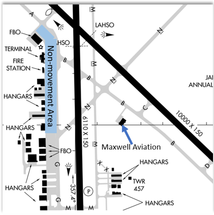
- Radio interference may occur when aircraft are parked against the hangars at KRS (FBO), and Aerosmith Aviation. Controllers will ask pilots to pull away from the hangars to clear radio interference.
- The area north of TWY G and ending at the beginning of TWY L and TWY A is a non-Movement Area.
- Due to TWR visibility, aircraft pulling out of Maxwell Aviation are not seen until reaching TWY B.
Takeoff/Departure
- Remain on TWR frequency while still in Class D airspace unless earlier frequency change is approved by TWR.
- If electing not to participate in TRSA service state “Negative TRSA Departure”.
Arrival/Landing
- Land and Hold-Short Operations (LAHSO)
| LDG RWY | HOLD–SHORT POINT | AVBL LDG DIST |
| RWY 31 | 18/36 | 8100 |
| RWY 36 | 13/31 | 4080 |
- If issued a LAHSO clearance and you are unable to comply, notify the TWR as soon as possible.
- TWR instructions will be RWY heading to 3000’ if executing a non-published missed approach.
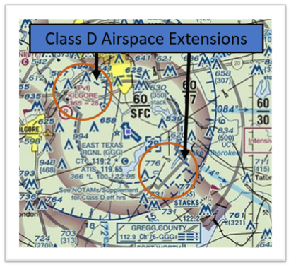
Avoidance Areas
- Sections of Class D airspace are extended, to 10 miles, for arriving and departing IFR aircraft. Maneuvering VFR aircraft should avoid these areas.
- See sectional chart.
Special Traffic (Military / Commercial / Helicopter, etc.)
- Military will fly initial at 2200 MSL unless otherwise stated.
- Helicopters can expect to depart from the ramp (Non-Movement Area).
Additional Information
- Displaced threshold on RWY 13.
- Extensive student flight training.
- Birds on and in vicinity of airport.
- All FBO’s are located on the west side of the field.