
Community Engagement — San Carlos
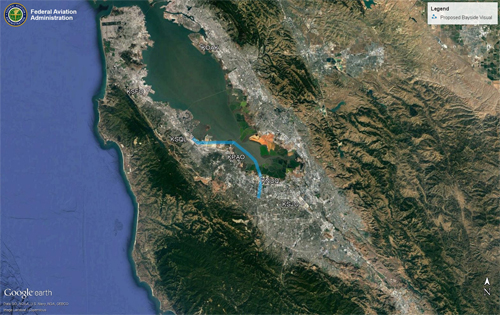
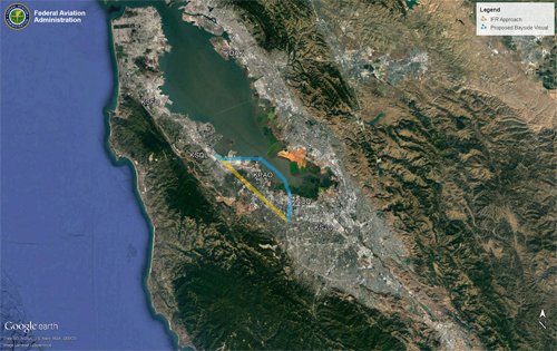
A Charted Visual Flight Procedure (CVFP) has been proposed for the San Carlos Airport (SQL). CVFPs may be established at some airports with control towers for the safety and efficiency of air traffic operations. Designed primarily for turbojet aircraft, CVFPs depict prominent landmarks, courses, and recommended altitudes to specific runways.
Pilots must have a charted visual landmark or a preceding aircraft in sight, and weather must be at or above the published minimums. When following a preceding aircraft, pilots are responsible for maintaining a safe approach interval and wake turbulence separation. Pilots must advise ATC if they are unable at any point to continue a charted visual approach or if the pilot loses sight of the preceding aircraft.
Supplemental Materials
- Proposed San Carlos Bayside Visual Approach
- Proposed San Carlos Bayside Visual Approach and Existing IFR Approach
- SQL Charted Visual Flight Procedure Briefing (PDF)
- SQL Community Workshop (PDF)
- SQL Fact Sheet (PDF)