
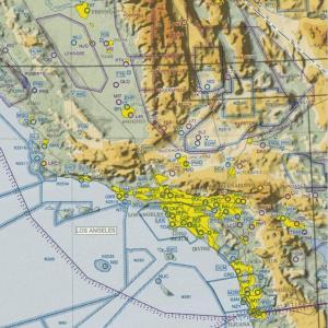
 U.S. VFR Wall Planning Chart is designed for VFR preflight planning and provides aeronautical and topographic information of the conterminous U.S. The aeronautical information includes airports, radio aids to navigation, Class B airspace and special use airspace. The topographic information includes city tint, populated places, principal roads, drainage patterns and shaded relief. This chart, 59x36 inches flat, is updated annually.
| Product | Product ID | Nautical miles/inch | Scale |
|---|---|---|---|
| U.S. VFR Wall Planning Chart | VFRWPC (Flat) | 43 | 1:3,100,000 |