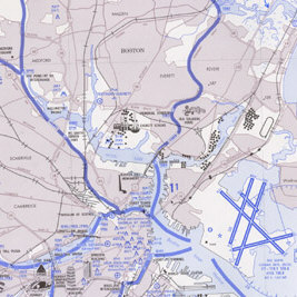
 Helicopter Route Charts are three-color charts that depict current aeronautical information useful to helicopter pilots navigating in areas with high concentrations of helicopter activity. Information depicted includes helicopter routes, four classes of heliports with associated frequency and lighting capabilities, NAVAIDS, and obstructions. In addition, pictorial symbols, roads, and easily-identified geographical features are portrayed. The scale is 1:250,000. These charts are updated every 56 days.
Information for All Helicopter Route Charts
| Chart Type |
Nautical miles/inch |
Nautical miles/cm |
Scale |
| Helicopter Route Charts |
1.7 |
0.68 |
1:125,000 |
Helicopter Route Chart
| Product |
Product ID |
| Baltimore-Washington |
HELDC |
| Boston |
HELBOS |
| Chicago |
HELCHI |
| Dallas-Ft. Worth |
HELDFW |
| Detroit |
HELDET |
| Houston |
HELHOU |
| Los Angeles |
HELLA |
| New York |
HELNY |
 Helicopter Route Charts are three-color charts that depict current aeronautical information useful to helicopter pilots navigating in areas with high concentrations of helicopter activity. Information depicted includes helicopter routes, four classes of heliports with associated frequency and lighting capabilities, NAVAIDS, and obstructions. In addition, pictorial symbols, roads, and easily-identified geographical features are portrayed. The scale is 1:250,000. These charts are updated every 56 days.