| Physical Address: 1800 Airport Terminal Way Ketchikan, AK 99901 Mailing Address: PO Box 6092 Ketchikan, AK 99901 |
Air Traffic Manager: Rebecca Smith |
Ketchikan Regulatory Notice, Special Air Traffic Rules, and Airport Traffic Patterns

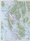
View Image (PDF, 514 KB) |

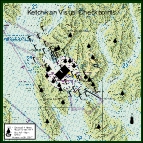
View Image (PDF, 625 KB) |


Regulatory Notice
Ketchikan International Airport
Special Air Traffic Rules & Airport Traffic Patterns
(14 CFR Part 93)
- Airspace
- Special air traffic rules and communication requirements are in effect for a pilot operating an aircraft under Visual Flight Rules (VFR) to, from, or in the vicinity of the Ketchikan International Airport or Ketchikan Harbor. These procedures are in effect below 3,000 feet MSL with the perimeter defined as the Ketchikan Class E surface area regardless of whether the Class E surface area is in effect.
- Communications
- When the Ketchikan Flight Service Station (FSS) is in operation, no person may operate an aircraft within the airspace specified above, or taxi onto the runway at Ketchikan International Airport, unless that person has established two-way radio communications with the Ketchikan FSS for the purpose of receiving traffic advisories. Continue to monitor the advisory frequency at all times while operating within the specified airspace. When the Ketchikan FSS is not in operation each pilot must continuously monitor and communicate, as appropriate, on the designated common traffic advisory frequency (CTAF) as follows:
- For inbound flights: Announce position and intentions when no less than 10 miles from Ketchikan International Airport. Monitor the designated frequency until clear of the movement area on the airport or Ketchikan Harbor.
- For departing flights: Announce position and intentions prior to taxiing onto the active runway on the airport or onto the movement area of Ketchikan Harbor. Monitor the designated frequency until outside the airspace described above. Announce position and intentions upon departing that airspace.
- Aircraft Operation
- When a pilot receives an advisory, from the Ketchikan FSS, that an aircraft is on final approach to the Ketchikan International Airport, that pilot must remain clear of the runway until the approaching aircraft has landed and has cleared the runway. Unless otherwise authorized by ATC, each person operating a large airplane or a turbine engine powered airplane shall:
- When approaching to land at the Ketchikan International Airport, maintain an altitude of at least 900 feet MSL until within three miles of the airport.
- After takeoff from the International Airport, maintain runway heading until reaching an altitude of 900 feet MSL.
- Recommended VFR Arrival and Departure Procedures and Traffic Patterns
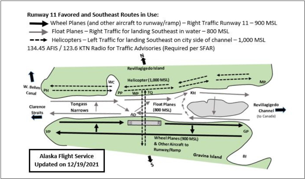
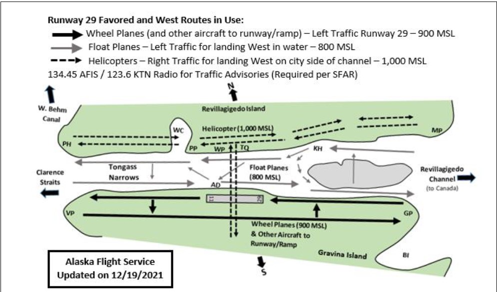
- Aircraft normally arrive and depart the Ketchikan Class E airspace via the Tongass Narrows. This results in aircraft passing very close in an area with very little maneuvering room. In response to the higher-than-normal risks and to ensure an acceptable margin of aviation safety, special VFR arrival and departure procedures/patterns for floatplanes, helicopters, and single-engine wheeled aircraft are in use for all VFR operations in the Ketchikan and Tongass narrows area. Copies of these procedures and patterns can be obtained from:
Ketchikan FSS
1800 Airport Terminal Building
Ketchikan, AK 99901
Mailing Address:
Ketchikan FSS
PO Box 6092
Ketchikan, AK 99901Juneau AFSS
9230 Cessna Drive
Juneau, AK 99801-9377Sitka FSS
800 Airport Road
Sitka, AK 99835
- The recommended pattern in use at the Ketchikan Harbor and Airport will be broadcast on the Ketchikan AFIS, 134.45 MHz.
- If the AFIS is out of service, Ketchikan FSS will provide recommended pattern information on 123.6 MHz.
- The Ketchikan Visual Check Point Table below is in NAD 83 (formatted in degrees, minutes, seconds) and is to be used with the picture shown at the top of this page.
| Location | NAD 83 | ||
|---|---|---|---|
| Code | Check Point | Latitude | Longitude |
| AB | Annette Bay | N 55° 16′ 46″ | W 131° 32′ 18″ |
| AD | Airport Dock | N 55° 21′ 29″ | W 131° 42′ 45″ |
| BI | Blank Inlet | N 55° 16′ 45″ | W 131° 40′ 02″ |
| BK | Base KTN USCG | N 55° 19′ 54″ | W 131° 37′ 32″ |
| BL | Bostwick Lake | N 55° 19′ 30″ | W 131° 44′ 40″ |
| CI | Channel Island | N 55° 23′ 41″ | W 131° 45′ 54″ |
| CO | Caamano Point | N 55° 29′ 52″ | W 131° 58′ 17″ |
| CP | Clover Pass | N 55° 28′ 43″ | W 131° 48′ 47″ |
| DI | Danger Island | N 55° 24′ 08″ | W 131° 45′ 53″ |
| DL | Doyon′s Landing | N 55° 19′ 52″ | W 131° 37′ 28″ |
| DM | Deer Mountain | N 55° 20′ 35″ | W 131° 35′ 57″ |
| DR | Dall Ridge | N 55° 17′ 50″ | W 131° 49′ 40″ |
| EC | East Clump | N 55° 20′ 41″ | W 131° 41′ 21″ |
| FM | Fawn Mountain | N 55° 19′ 04″ | W 131° 33′ 15″ |
| GI | Guard Island | N 55° 26′ 46″ | W 131° 52′ 54″ |
| GP | Gravina Point | N 55° 17′ 10″ | W 131° 37′ 06″ |
| HM | High Mountain | N 55° 21′ 40″ | W 131° 47′ 46″ |
| JH | Judy Hill | N 55° 17′ 46″ | W 131° 38′ 45″ |
| KH | Ketchikan Harbor | N 55° 20′ 42″ | W 131° 39′ 31″ |
| KL | Ketchikan Lake | N 55° 22′ 52″ | W 131° 37′ 49″ |
| LL | Long Lake | N 55° 19′ 08″ | W 131° 41′ 30″ |
| MB | Mud Blight | N 55° 25′ 11″ | W 131° 46′ 29″ |
| MP | Mountain Point | N 55° 17′ 33″ | W 131° 32′ 23″ |
| PH | Point Higgins | N 55° 27′ 26″ | W 131° 50′ 02″ |
| PP | Peninsula Point | N 55° 22′ 55″ | W 131° 44′ 17″ |
| RC | Refuge Cove | N 55° 24′ 11″ | W 131° 44′ 55″ |
| RR | Rosa Reef | N 55° 24′ 49″ | W 131° 48′ 10″ |
| SP | Sunny Point | N 55° 21′ 19″ | W 131° 41′ 21″ |
| VB | Vallenar Bay | N 55° 23′ 24″ | W 131° 51′ 36″ |
| VP | Vallenar Point | N 55° 25′ 34″ | W 131° 51′ 06″ |
| WC | Ward Cove | N 55° 23′ 45″ | W 131° 44′ 21″ |
| WK | Whipple Creek | N 55° 26′ 16″ | W 131° 48′ 04″ |
| WL | Ward Lake | N 55° 24′ 44″ | W 131° 42′ 00″ |
| WR | Walden Rocks | N 55° 16′ 13″ | W 131° 36′ 32″ |
Last updated:
