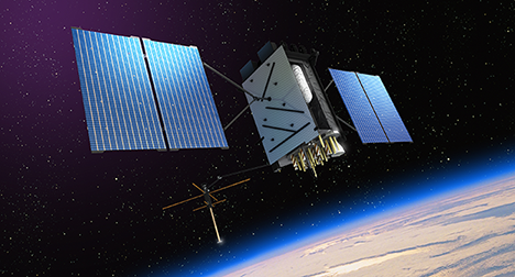
The Global Positioning System (GPS) is a space-based radio-navigation system consisting of a constellation of satellites broadcasting navigation signals and a network of ground stations and satellite control stations used for monitoring and control. Currently 31 GPS satellites orbit the Earth at an altitude of approximately 11,000 miles providing users with accurate information on position, velocity, and time anywhere in the world and in all weather conditions.
GPS is operated and maintained by the Department of Defense (DoD). The National Space-Based Positioning, Navigation, and Timing (PNT) Executive Committee (EXCOM) provides guidance to the DoD on GPS-related matters impacting federal agencies to ensure the system addresses national priorities as well as military requirements. The DoD and the Department of Transportation co-chair the EXCOM.The U.S. Coast Guard acts as the civil interface to the public for GPS matters and receives problem reports from civil users. The Federal Aviation Administration oversees the use of GPS in civil aviation and receives problem reports from aviation users.
History and Development
The Global Positioning System, formally known as the Navstar Global Positioning System, was initiated as a joint civil/military technical program in 1973. The joint program combined the best aspects of several service-centric capabilities including TRANSIT, TIMATION, and Project 621B to reduce the proliferation of navigation aids. By creating a system that overcame the limitations of many existing navigation systems, GPS became attractive to a broad spectrum of users worldwide. The Global Positioning System has been successful in virtually all navigation and timing applications, and because its capabilities are accessible using small, inexpensive equipment, GPS is being used in a wide variety of applications across the globe.


