
NAS Implementation - Procedures - Ground Based Augmentation System (GBAS) Landing System (GLS)
"GLS" is the acronym for Ground Based Augmentation System (GBAS) Landing System.
GLS was originally published as a placeholder for both Wide Area Augmentation System (WAAS) and GBAS minima and marked as N/A since no minima was published.
As the concepts for GBAS and WAAS procedure publication have evolved, it was decided that GLS will now only be associated with GBAS and will be on a separate approach chart. For more information on GLS approach procedures, please refer to the AIM section 1-1-21 and section 5-4-5.
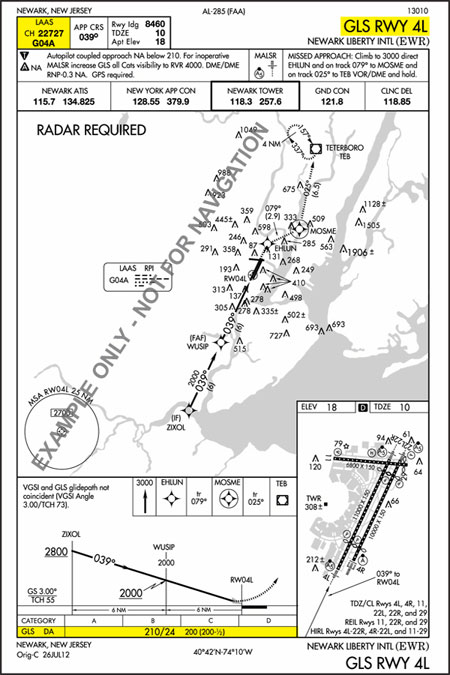
Example: GLS RWY 4L at Newark Liberty International (EWR)
The Ground Based Augmentation System (GBAS) program is managed by the FAA Aviation NextGen and Operations Planning Service Unit (ANG-C32) at the FAA William J. Hughes Technical Center. More information about GBAS can be found at http://laas.tc.faa.gov/.
Note: The U.S. version of the Ground Based Augmentation System (GBAS) was formerly referred to as the Local Area Augmentation System (LAAS). The worldwide community adopted GBAS as the official term for this type of navigation system. To coincide with international terminology, the FAA also adopted the term GBAS to be consistent with the international community.
Last updated: Friday, December 23, 2016