
 North Atlantic Route Chart and the Western Atlantic Route System Chart are designed for FAA Controllers to monitor transatlantic flights, this 5-color chart shows oceanic control areas, coastal navigation aids, oceanic reporting points, NAVAID coordinates and reporting points. Full Size Chart 29 3/4x20 1/2, shipped folded to 5 x 10 inches only. Revised every 56 days.
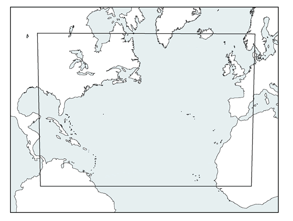
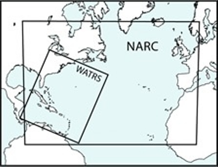
A separate index shows the coverage of the North Atlantic Route Chart and the Western Atlantic Route System Chart
| Product | Product ID | Nautical miles/inch | Scale |
|---|---|---|---|
| North Atlantic Route Chart - Folded (Reduced Size) | NARC | 150.8 | 1:11,000,000 |
| North Atlantic Route Chart - Flat (Full Size) | NARCZ | 113.1 | 1:8,250,000 |
| Western Atlantic Route System Chart - Flat (Full Size) | WATRS | 82 | 1:6,000,000 |