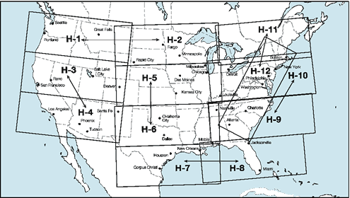
 IFR Enroute High Altitude Charts (Conterminous U.S. and Alaska) are designed
for navigation at or above 18,000 ft MSL. This four color series includes:
IFR Enroute High Altitude Charts (Conterminous U.S. and Alaska) are designed
for navigation at or above 18,000 ft MSL. This four color series includes:
- Jet Route Structure
- RNAV Q-Routes
- VHF radio aids to navigation (frequency, ID, channel, geographic coordinates)
- Selected airports
- Reporting Points
- NRS (Navigation Reference System) Waypoints
- Revised every 56 days
Scale Information
| Chart Type |
Nautical miles/inch |
| Instrument Flight Rules (IFR) Enroute High Altitude Chart for the Conterminous U.S. |
20 |
| Instrument Flight Rules (IFR) Enroute High Altitude Chart for Alaska |
Varies from 18 to 45 |
Product Name and FAA Product ID
High Altitude Enroute (Conterminous U.S.)
| Product |
Product ID |
| H 1/2 |
EHUS1 |
| H 3/4 |
EHUS3 |
| H 5/6 |
EHUS5 |
| H 7/8 |
EHUS7 |
| H 9/10 |
EHUS9 |
| H 11/12 |
EHUS11 |
| Full Set |
EHUSSET |
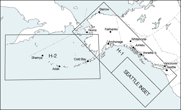
High Altitude Enroute (Alaska)
| Product |
Product ID |
| Alaska H1/H2 |
EHAK1 |
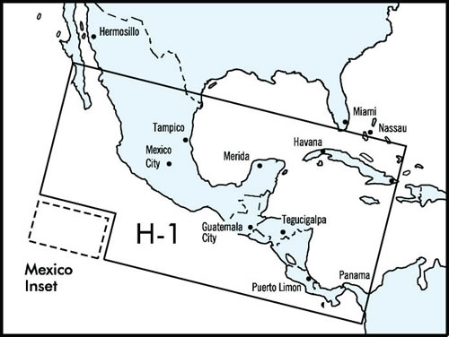
High Altitude Enroute (Caribbean)
| Product |
Product ID |
| Caribbean H1 |
DEHCB1 |
