In-Flight Icing
In-Flight Icing (IFI) continues to be a safety issue for aviation as it can distort the flow of air over the wing, increase drag, and adversely affect handling qualities. An airplane may stall at much higher speeds and lower angles of attack than normal. It can roll or pitch uncontrollably, and recovery may be impossible.
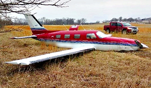
National Transportation Safety Board findings showed that during the period 2008 – 2021, there were an average of 4 aircraft accidents and 5 fatalities per year that identified structural, in-flight icing as a cause or factor.
In addition, regulatory and policy changes have resulted in a shift in IFI research strategy. Traditional IFI forecasts focused on the potential and intensity of icing ranging from trace, light, moderate, to heavy. FAA policy changes in Title 14, Code of Federal Regulations Part 25 [Airworthiness Standards: Transport Category Aircraft], Appendix C and Appendix O (November 14, 2014) were created to improve the safety in in-flight icing and supercooled large drop (SLD) conditions. These regulatory and policy changes have resulted in the following new aircraft icing certification categories:
- No cloud
- Cloud but no icing
- Appendix C icing conditions with maximum drop diameters (Dmax) < 100 microns
- Appendix O icing conditions with Dmax 100 – 500 microns (Freezing Drizzle - FZDZ)
- Appendix O icing conditions with Dmax > 500 microns (Freezing Rain - FZRA)
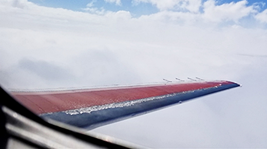
To mitigate the safety hazard, IFI research is focused on enhancing automated diagnostic and forecast capabilities used by pilots, dispatchers and meteorologists to make timely decisions on icing threat areas, optimum routings, and areas to avoid in compliance to updated regulations and policy changes.
IFI Capabilities
The current IFI operational capabilities operated and maintained by the National Weather Service (NWS) are:
- Current Icing Product (CIP) - an hourly diagnostics tool that makes use of numerical weather prediction (NWP) model output, satellite imagery, weather radar, lightning data, surface weather observations, and pilot reports by combining individual data sources into an integrated algorithm that makes use of the strengths of each capability while simultaneously minimizing individual weaknesses.
- Forecast Icing Product (FIP) - a forecast version of CIP designed to mimic the technique of combining information from various sources that provides hourly forecasts out to 18 hours.
The IFI program is focused on improving CIP and FIP by incorporating enhancements in NWP, weather satellites, and weather radar, and developing enhancements for Appendix C and O guidance.
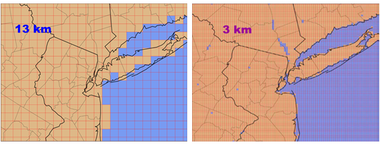
The NWP model output will transition to either the High Resolution Rapid Refresh (HRRR) model or the Rapid Refresh Forecast System (RRFS), both of which have a horizontal grid spacing of 3 kilometers. This higher resolution provides improved terrain depiction, along with the increased use of explicit moisture variables forecasted by the models.
The newest generation of Geostationary Operational Environmental Satellites (GOES) provides an opportunity to enhance real time detection of aircraft icing hazards. CIP will also be modified to incorporate Next Generation Weather Radar (NEXRAD) dual-polarization data from the Multi-Radar Multi-Sensor (MRMS) national mosaic. Research will also be conducted into the ability to diagnose inflight icing conditions based on Appendix C and O drop size.
| CIP & FIP version 1 (v1 - operational) | CIP & FIP version 2 (v2) |
| Inputs from NWP model and observations | Inputs from NWP model and observations |
| Derivation of icing conditions largely based on interpretation of meteorological scenario | Explicit use of model microphysics fields plus meteorological scenario analyses |
| Rules-based algorithms applied | Rules-based algorithms adapted for high resolution fields |
| Information blended with fuzzy logic methodology | Information blending |
| Output products are icing probability, icing severity category, SLD potential | Icing probability, severity, and drop-size classification |
CIP and FIP v2 enhancements are targeted for initial NWS operational implementation in 2026 and will include higher horizontal resolution and the use of additional weather radar and satellite information. Future versions will provide drop size information in accordance with the aircraft certification criteria. Development of this capability is dependent upon a full and complete analysis of the In-Cloud Icing and Large-drop Experiment (ICICLE) field campaign data which provides valuable in-cloud measurements of in-flight icing parameters. ICICLE was a FAA sponsored program conducted in the winter of 2019 to collect data to evaluate icing products and advance the understanding of cloud processes leading to in-flight icing. It was a multi-government agency program with international participation that provides a wealth of data for development purposes. Future versions of CIP and FIP will add other refinements for improved accuracy and applicability to emerging aviation users, including rotorcraft and unmanned aircraft systems.
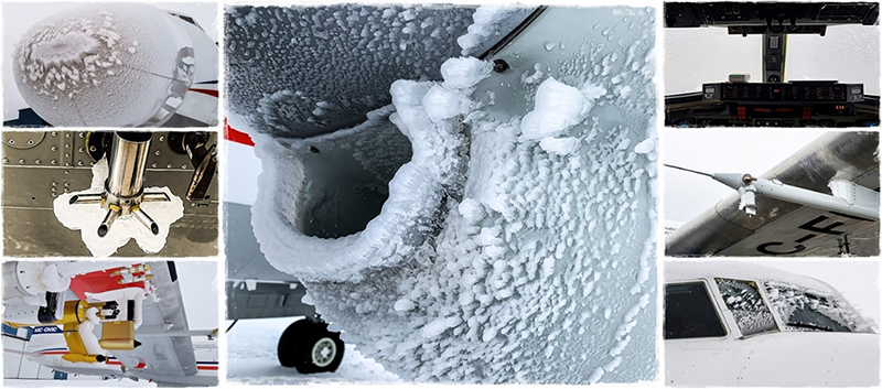
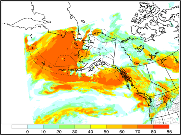
Weather in Alaska presents a special challenge for icing detection and forecasting due to terrain, air-sea interaction, variation in weather across the state, and the lack of weather observations. An IFI product, Icing Product Alaska (IPA), provides experimental guidance for Alaska and surrounding areas. IPA was developed using the CIP and FIP as a foundation. Development of CIP and FIP v2 includes providing a capability for Alaska; the experimental IPA will be then be retired.
